Mount Pantokrator
The Verdict
The clearest demonstration of how close Corfu sits to Albania. Worth the drive on a clear day, pointless in haze.
Why go
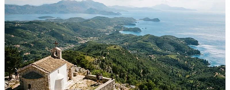
At 906 meters, Pantokrator is Corfu's highest peak, anchoring the limestone massif that dominates the northern third of the island. The ascent starts among lower olive groves and tight village switchbacks before breaking into bare, wind-scoured karst. Because a paved road runs the entire way to the crest, you share the summit platform with telecommunications masts, a large radar installation, and the seventeenth-century Monastery of Pantokrator. It is an operational, built-up peak rather than a wilderness escape, but it provides immediate geographic orientation for the northern Ionian. From the perimeter wall, the strait separating Corfu from Albania narrows to a distinct channel, bringing the barren ridges of the mainland into sharp relief. To the south, the forested spine of Corfu tapers toward Paxos. The trade-off is entirely atmospheric. On crisp days following rain or strong northerly winds, you can track the coastline well past Sarandë. In midsummer heat, maritime haze and thermal smog obscure the view below, leaving you on a hot concrete terrace surrounded by radio antennas.
Understand the place
Corfu's highest point, at the north end of the island, with a summit chapel and a road all the way up.
Related
More mountains in Greece
Sources
Booking links
Commercial links: we may earn a commission if you book through them, at no extra cost to you.
Plan this trip
Greece Field Guide helps you decide. When you're ready to arrange it, take your saved places to an itinerary.